 Svalbard
Glaciers thin around Norway’s Longyearbyen as the Arctic warms
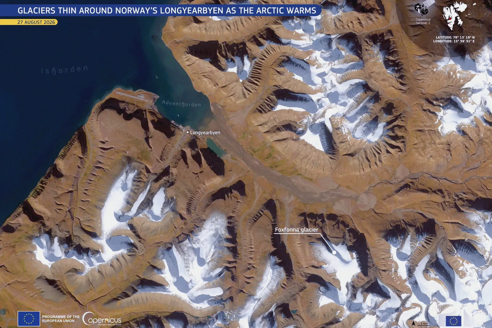
An image of the day on eu-space.europa.eu shows Longyearbyen, the largest settlement in the Norwegian archipelago of Svalbard. The town stands on the shore of Adventfjorden, and a Copernicus Sentinel-2 satellite took the picture on 27 August 2026.
In the image, mountains and ice fields surround the town. The Foxfonna glacier is visible south-east from the settlement. Brown ground, mostly free of snow, contrasts with white patches of ice, while the fjord water is dark blue.
According to eu-space.europa.eu, Longyearbyen lies roughly midway between mainland Norway and the North Pole, among the northernmost settlements in the world. It sits in one of the fastest-warming regions of the Arctic. Permafrost is ground with a temperature of 0 °C or lower for a minimum of two consecutive years. It is thawing as the air warms, and the change can have effects on local infrastructure and on water resources.
The surrounding ice masses are also thinning and retreating, and the pace is increasing. Glaciologists at UNIS (the University Centre in Svalbard) said Foxfonna loses 1 to 4 metres of thickness each year.
Copernicus Sentinel-2 satellites supply information used to monitor Arctic glaciers and snow cover, eu-space.europa.eu adds. This helps track retreat, assess environmental change and plan climate adaptation measures in polar regions.
Coverage: EU Space Policy